
The early railway companies would always do what they could to reach the towns.
There were constraints, however. The railways avoided slopes and they would aim to keep the track free of awkward bends, so some towns were inconveniently positioned.
There are several instances where the closest that the track could approach the town was as much as a mile distant. Much of the town’s activity would begin to move closer to the station and the town would develop a new centre, resulting in “Old Town” and “New Town”.
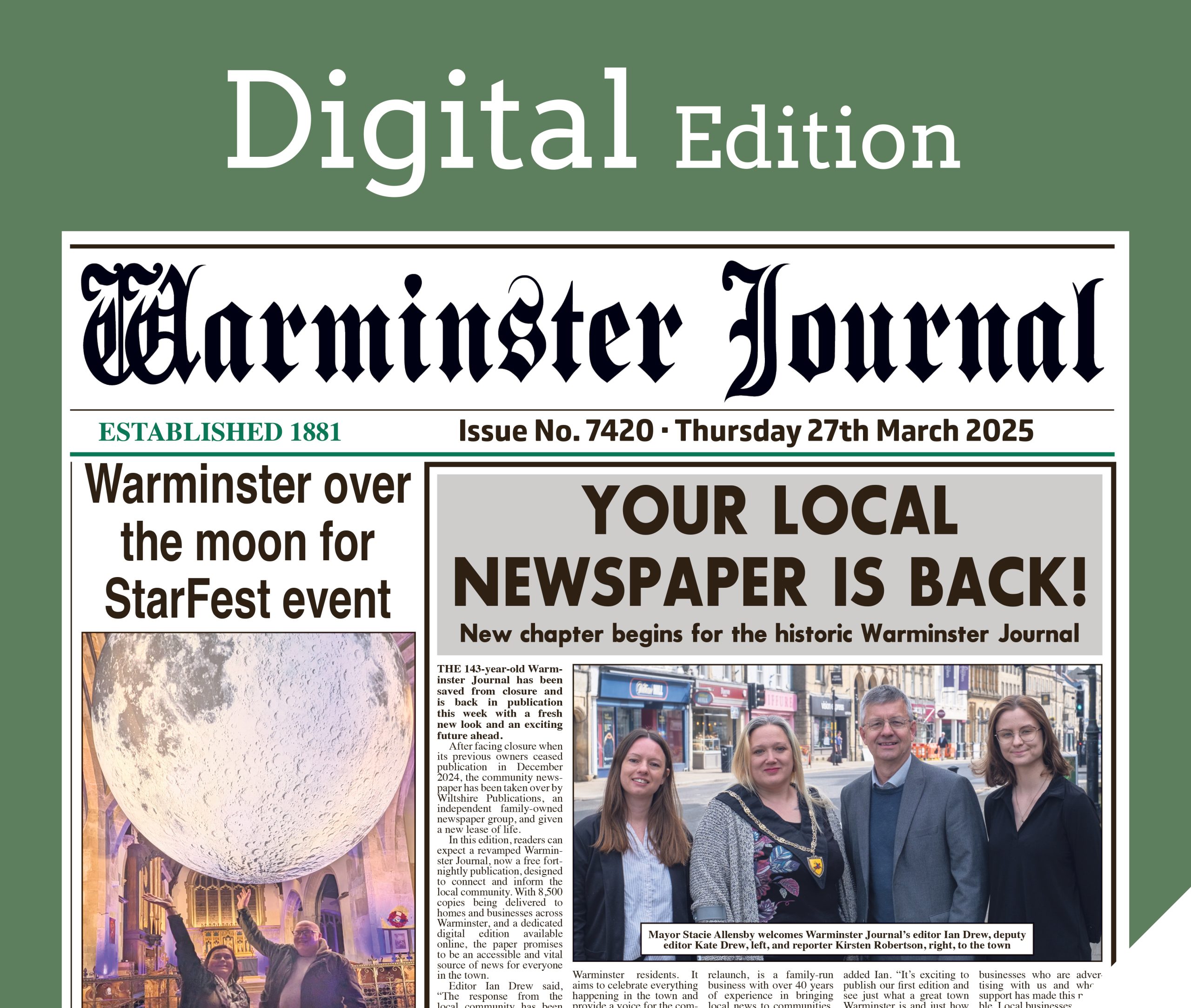
This problem did not apply to Warminster. The line could approach Warminster quite easily, so then Warminster had a new problem. Where should the station be sited? Having decided where the station should be, it must be accessible. In Warminster, making the station accessible resulted in Station Road.
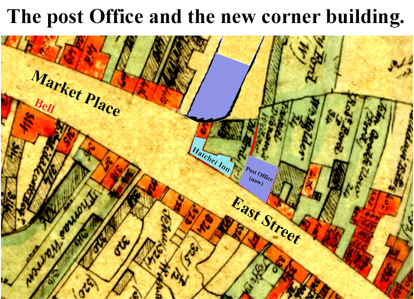
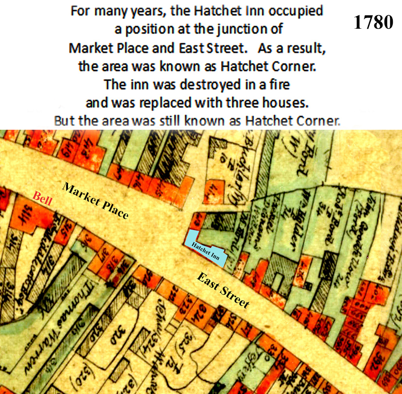
Three map sections show the major alterations necessary to construct Station Road. The old map, drawn in 1780, shows the original area where Market Place meets East Street.
The next map is the original map with our Post Office (one corner of the new junction) and the new, rounded corner building, superposed. These two new buildings are shown in blue.
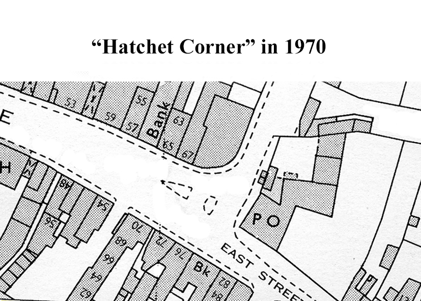
The third map shows the junction in 1970 and this is the corner that we know today.
Initially, our railway line was only a branch line from the main line at Westbury. It was later extended to Salisbury.
When you look closely at the three maps, it is interesting to see how much has changed.
It is also interesting, however, to see how much has stayed very much the same.


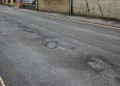

, which identified a number of locations as suitable for reduced speeds after assessment work and traffic monitoring.
The Wiltshire Council consultation is now open to residents and businesses, and runs until 13th July.
Read more on our website, the link is in our bio.")


 has raised £11,000 for the school in less than two years through a wide range of community events, including school fetes, colourful rainbow runs, discos and quizzes.
The funding has enabled the school to invest in a full class set of Galaxy tablets and has also been used to increase the number of iPads available to pupils.
Read more on our website, the link is in our bio.")
